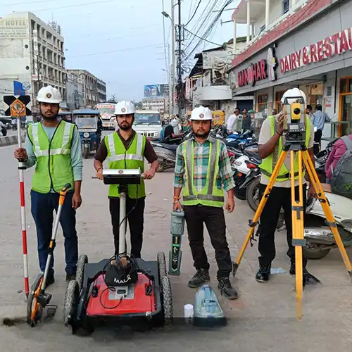
GTG GEO Technical Solution delivers professional Ground Penetrating Radar Survey in Prayagraj for a variety of technical and development requirements. Surveying is often the first step toward understanding a site properly, particularly when design and construction depend on accurate measurements. Our services cover subsurface investigation, geographic positioning, aerial mapping, terrain measurement, construction setting out and underwater mapping. Instead of depending on one surveying technique for every assignment, our team considers what information is actually needed and chooses the appropriate method. This helps make the survey more relevant to the project and allows engineers, contractors, developers and planners to work with better site information.
As a trusted Ground Penetrating Radar Survey Service in Prayagraj, GTG GEO Technical Solution works with a practical understanding of field requirements. Different survey technologies can provide different types of information, and knowing when to use each method is an important part of professional surveying. GPR and Ground Penetrating Radar surveys can investigate hidden underground features, while DGPS and Total Station surveys provide accurate positional references. Drone and LiDAR surveys are useful for collecting information over larger areas, and Topographic and Land Surveys describe existing ground conditions. Building Layout Surveys help transfer planned dimensions to the construction site, while Bathymetric Surveys provide depth and underwater terrain information. Together, these services can support projects from initial investigation through construction and documentation.
Organizations looking for the Best Ground Penetrating Radar Survey Service Provider in Prayagraj can benefit from the integrated capabilities of GTG GEO Technical Solution. Our focus is on delivering survey information that has a clear purpose and can contribute to real project decisions. We consider site accessibility, terrain, survey coverage and required outputs while preparing the fieldwork. Combining multiple surveying methods can also provide a more complete picture where a project involves both existing structures and surrounding land or underground conditions. With careful field execution and appropriate technology, we help clients obtain reliable information for construction planning, infrastructure development, mapping, site assessment and engineering applications across India.
Phone
+91 9315601033Address
F-13-KH NO -10/1 Jeewan Park Pankha Road, Uttam Nagar, New Delhi -110059, India