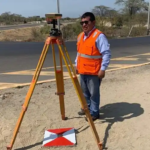
GTG GEO Technical Solution provides dependable DGPS Survey Service Provider in Delhi for construction, infrastructure, land development and mapping requirements. Each survey technique provides a different type of information, making it important to select the right method for the actual project. Our team can investigate underground conditions through GPR, establish accurate geographic positions using DGPS, measure land and structures through Total Station technology, and capture extensive site information with Drone and LiDAR solutions. Topographic and Land Surveys help document existing terrain, while Building Layout Surveys assist in transferring planned dimensions accurately to the construction site. For projects involving water bodies, Bathymetric Surveying can provide valuable information about underwater depth and terrain. By bringing these capabilities together, GTG GEO Technical Solution helps clients build a more complete understanding of their site before making important technical decisions.
As an experienced DGPS Survey Service Provider in New Delhi, GTG GEO Technical Solution understands that reliable survey results depend on both suitable technology and proper field execution. A construction project, for example, may require topographic information before design, DGPS or Total Station control for accurate positioning, and Building Layout Survey support during construction. Similarly, a large infrastructure project may benefit from Drone or LiDAR mapping to understand extensive areas, while GPR can help investigate possible underground features before excavation. Our professionals assess the purpose, location and conditions of each assignment before selecting the appropriate surveying approach. This project-specific method allows us to provide useful information instead of applying the same process to every site.
For clients searching for the Best DGPS Survey Service Provider in India, GTG GEO Technical Solution offers a broad range of professional surveying capabilities under one roof. Our focus is on collecting accurate and meaningful information that can support real-world planning and engineering decisions. We understand that survey data may be used by architects, civil engineers, contractors, developers, infrastructure companies and project managers, so clarity and consistency are important throughout the process. From the first site assessment to field measurements and final survey outputs, our team works with attention to the intended application of the data. The combination of conventional surveying methods and modern geospatial technologies enables us to support projects of different scales and complexities across India.
Phone
+91 9315601033Address
F-13-KH NO -10/1 Jeewan Park Pankha Road, Uttam Nagar, New Delhi -110059, India