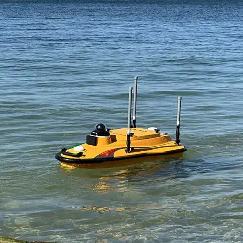
GTG GEO Technical Solution offers professional Bathymetric Survey Service in Delhi for projects that require measurement and mapping of underwater terrain. A Bathymetric Survey is used to understand the depth, shape and characteristics of the bottom surface of water bodies such as lakes, reservoirs, rivers, canals and other aquatic areas. Accurate underwater information can be important for dredging, water resource management, reservoir studies, infrastructure planning and environmental assessment. Our team plans the survey according to the type of water body, required coverage and project objective. Measurements are collected systematically to build an understanding of underwater elevations and depth variations. This information can help engineers and planners assess changes in the waterbed and make informed decisions about proposed or existing aquatic infrastructure. Professional survey planning is important because water conditions, accessibility and depth can influence field operations.
As a reliable Bathymetric Survey Service Provider in New Delhi, GTG GEO Technical Solution uses appropriate surveying techniques and equipment to collect underwater spatial information. Bathymetric surveying may involve positioning systems combined with depth-measuring instruments to establish the relationship between geographic coordinates and underwater elevations. Our professionals focus on maintaining consistent survey coverage and suitable reference control throughout the fieldwork. Depending on the project, the resulting information may support depth charts, contour mapping, underwater terrain models and volume calculations. Such information can be useful when assessing sedimentation, planning dredging operations or studying changes in reservoir capacity. We understand that water-based surveys require careful preparation, and our team considers site accessibility, water conditions and project requirements before conducting the field survey.
For clients seeking the Best Bathymetric Survey Service in India, GTG GEO Technical Solution provides specialized underwater mapping support for engineering and water-related projects. Reliable bathymetric information can help organizations understand the present condition of a water body and plan future activities more effectively. Survey data may be used to calculate underwater volumes, identify depth variations and support the design or maintenance of aquatic infrastructure. Our professionals emphasize systematic data collection and clear presentation of survey results so that technical teams can use the information for further analysis. Bathymetric surveys can also complement land and topographic surveys where projects extend from dry land into water. With a practical approach and suitable surveying technology, GTG GEO Technical Solution supports clients requiring dependable underwater terrain information across different project environments.
Phone
+91 9315601033Address
F-13-KH NO -10/1 Jeewan Park Pankha Road, Uttam Nagar, New Delhi -110059, India